Technical Information
MAPS
February 20th - Model Event
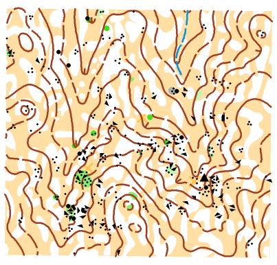
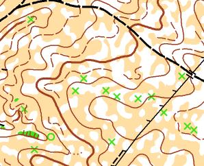
AZENHAS DA SEDA MAP
Scale 1:10000 - 5 meters contour interval
The terrain is typical Alentejo, or either, it's cork-oak and holm-oak terrain, easy running but moderatelly hilly. There are several rocky elements and vegetation will be the usual for the time of the year: fresh, green and short. There is also a good net of tracks and paths.
Map Makers: Luís Sérgio
Control choices and courses: Pedro Fernandes
Map samples:
Area photo:

February 21st - Middle Distance
MATA DO CABEÇÃO MAP
Scale 1:10000 - 5 meters contour interval
Hilly terrain in a pine tree national forest with no rocky elements.
Map Maker: Luís Sérgio
Courses Planner: Rui Botão
Map samples:
Area photo:

Night orienteering event in Cabeção
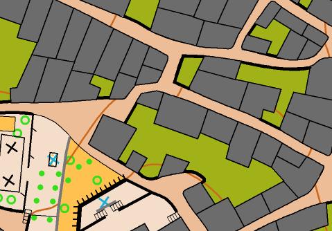
VILA DO CABEÇÂO MAP
Scale 1:5000 - 5 meters contour interval
Urban area in a rural village.
Map Maker: Luís Santos
Courses Planner: José Perleques
Map sample:
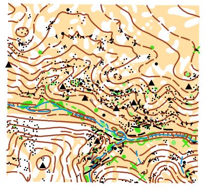
February 22nd - Long Distance WRE
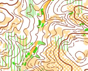
TORRE DAS ÁGUIAS MAP
Scale 1:15000 - 5 meters contour interval
Hilly terrain in cork-oak and holm-oak terrain with rocky elements only on 10% of the area.
Map Makers: Alexandre Soares dos Reis and Valdemar Sendim
Courses Planner: Luís Santos
Map samples:
Area photo:

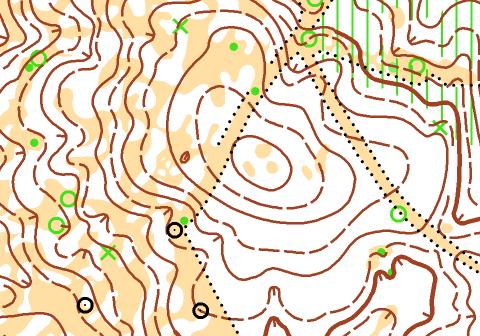
February 23rd - Middle Distance
SÃO MIGUEL/REMENDO MAP
Scale 1:10000 - 2,5 meters contour interval
Cork-oak and holm-oak terrain, wavy, fast, of easy running. Similar to model event area but with more rocky elements. Vegetation will be the usual for the time of the year: fresh, green and short.
Map Makers: Tiago Aires and Raquel Costa
Courses Planner: Tiago Aires
Map sample:

Area photo:

Orienteering Show
CAMPO DO CABEÇÃO MAP
Scale 1:500
Multi courses and multi map event in Campo do Cabeção.
Map Makers: Luís Santos and Nelson Graça
Courses Planner: Luís Santos
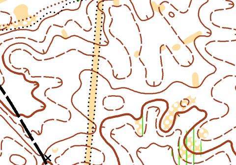
February 24th - Intermediate distance
Closing day with arrival and closing ceremony on the same location as on day 3, with a new map that was created by the gathering of Caeira map and Casas Velhas/Remendo map.
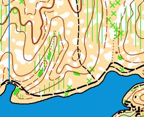
REMENDO/CAEIRA/CASAS VELHAS MAP Scale 1:10000 - 2,5 meters contour interval
Cork-oak and holm-oak terrain, wavy, fast, of easy running. Many rocky and vegetation elements. Vegetation will be the usual for the time of the year: fresh, green and short.
Map Makers: Tiago Aires and Raquel Costa, old area (50%) revised by Luís Santos.
Courses Planner: Tiago Aires.
Map samples:


Area photos:


February 20th - Model Event
AZENHAS DA SEDA MAP
Scale 1:10000 - 5 meters contour interval
The terrain is typical Alentejo, or either, it's cork-oak and holm-oak terrain, easy running but moderatelly hilly. There are several rocky elements and vegetation will be the usual for the time of the year: fresh, green and short. There is also a good net of tracks and paths.
Map Makers: Luís Sérgio
Control choices and courses: Pedro Fernandes
Map samples:
Area photo:
February 21st - Middle Distance
MATA DO CABEÇÃO MAP
Scale 1:10000 - 5 meters contour interval
Hilly terrain in a pine tree national forest with no rocky elements.
Map Maker: Luís Sérgio
Courses Planner: Rui Botão
Map samples:
Area photo:
Night orienteering event in Cabeção
VILA DO CABEÇÂO MAP
Scale 1:5000 - 5 meters contour interval
Urban area in a rural village.
Map Maker: Luís Santos
Courses Planner: José Perleques
Map sample:
February 22nd - Long Distance WRE
TORRE DAS ÁGUIAS MAP
Scale 1:15000 - 5 meters contour interval
Hilly terrain in cork-oak and holm-oak terrain with rocky elements only on 10% of the area.
Map Makers: Alexandre Soares dos Reis and Valdemar Sendim
Courses Planner: Luís Santos
Map samples:
Area photo:
February 23rd - Middle Distance
SÃO MIGUEL/REMENDO MAP
Scale 1:10000 - 2,5 meters contour interval
Cork-oak and holm-oak terrain, wavy, fast, of easy running. Similar to model event area but with more rocky elements. Vegetation will be the usual for the time of the year: fresh, green and short.
Map Makers: Tiago Aires and Raquel Costa
Courses Planner: Tiago Aires
Map sample:
Area photo:
Orienteering Show
CAMPO DO CABEÇÃO MAP
Scale 1:500
Multi courses and multi map event in Campo do Cabeção.
Map Makers: Luís Santos and Nelson Graça
Courses Planner: Luís Santos
February 24th - Intermediate distance
Closing day with arrival and closing ceremony on the same location as on day 3, with a new map that was created by the gathering of Caeira map and Casas Velhas/Remendo map.
REMENDO/CAEIRA/CASAS VELHAS MAP Scale 1:10000 - 2,5 meters contour interval
Cork-oak and holm-oak terrain, wavy, fast, of easy running. Many rocky and vegetation elements. Vegetation will be the usual for the time of the year: fresh, green and short.
Map Makers: Tiago Aires and Raquel Costa, old area (50%) revised by Luís Santos.
Courses Planner: Tiago Aires.
Map samples:
Area photos: